← Latest news 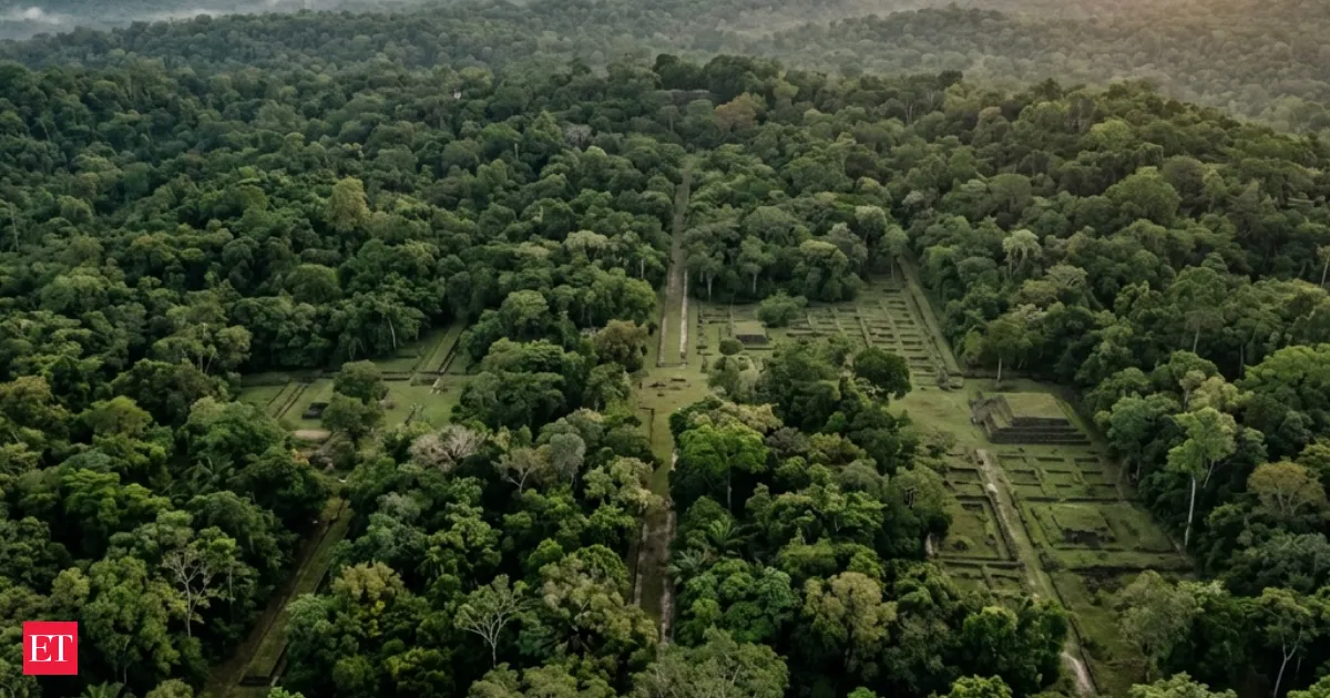
LiDAR reveals a hidden city grid under tropical forests changing archaeology forever
Science
Published on 12 May 2026
Laser mapping shows roads and terraces in plain sight
Airborne LiDAR laser scans are uncovering concealed urban layouts beneath dense tropical forests, revealing roads, platforms, and settlements that had escaped detection. By penetrating foliage without disturbing the environment, the mapping technique speeds surveys across large regions. Researchers say it suggests ancient tropical civilizations were bigger and more connected than previously believed, and it is now pointing archaeologists to new sites.
- LiDAR lasers can “see” through jungle canopies to map hidden structures
- New scans reveal roads terraces and settlement patterns
- The method surveys large areas without environmental disruption
- Findings suggest ancient tropical civilizations were more connected than expected
Read the full story at The Economic Times
This summarization was done by Beige for a story published on ![]() The Economic Times
The Economic Times