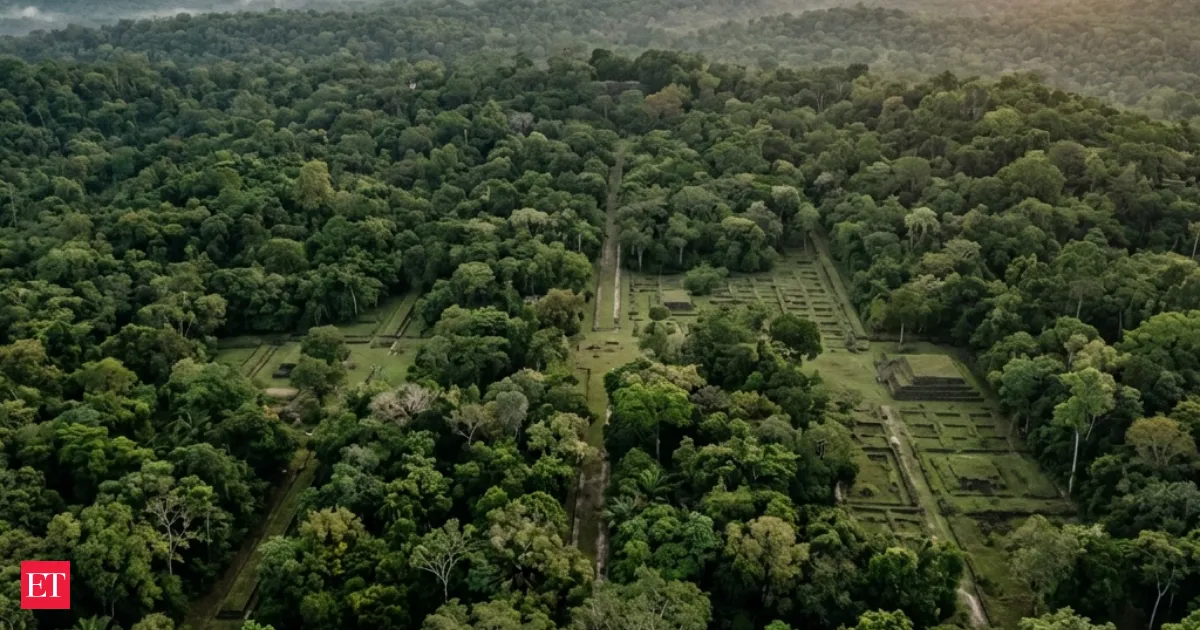
Airborne LiDAR laser scans are uncovering concealed urban layouts beneath dense tropical forests, revealing roads, platforms, and settlements that had escaped detection. By penetrating foliage without disturbing the environment, the mapping technique speeds surveys across large regions. Researchers say it suggests ancient tropical civilizations were bigger and more connected than previously believed, and it is now pointing archaeologists to new sites.
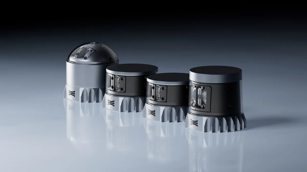
Ouster says its new color lidar can capture depth and image data simultaneously, a longtime goal for perception systems. CEO Angus Pacala tells TechCrunch the approach could reduce reliance on separate camera setups by combining visual detail with 3D mapping in a single sensor. If it works at scale, it could shift how autonomous and mapping hardware is designed.
Your news, in seconds
Get the Beige app — every story in 60 words, updated hourly. Free on iOS & Android.
Olee.Space, a photonics and defense technology firm, has appointed Venkateswara Gowtama Mannava, former Chairman and Managing Director of Bharat Electronics Limited, as its Strategic Production Advisor. With more than four decades of experience, he will help develop advanced defense electronics such as LIDAR and secure communication networks, supporting India’s push for self-reliance in critical technologies.
Swipe through stories, personalise your feed, and save articles for later — all on the app.