Sarvam AI and Pixxel are joining forces to develop Pathfinder, India’s first orbital AI system designed to process satellite imagery in space. Instead of streaming raw data to Earth, the mission will use onboard intelligence to convert it into actionable insights first, aiming to speed decisions for disaster response, agriculture, and environmental monitoring.
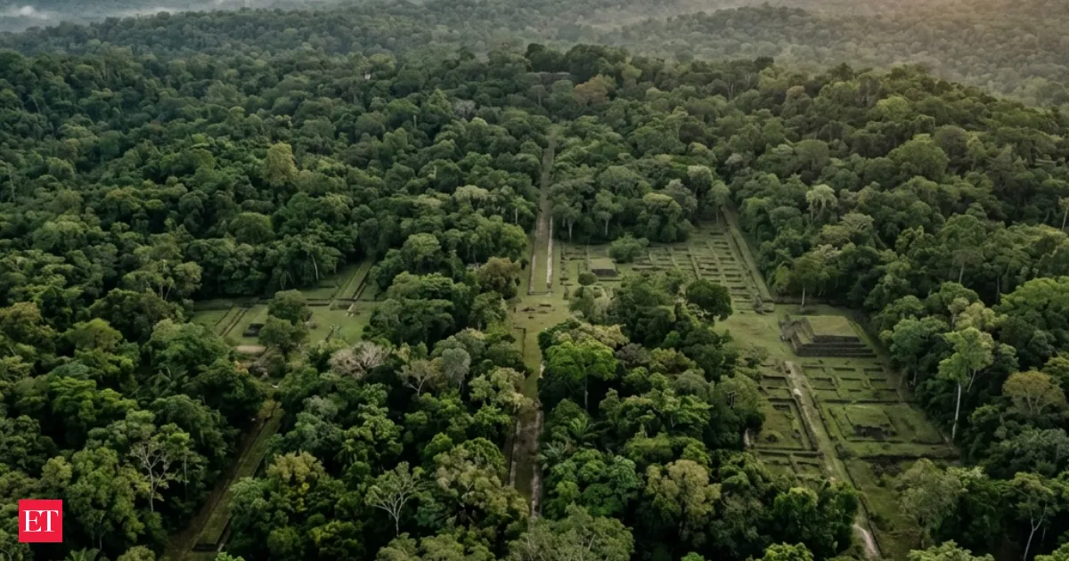
Airborne LiDAR laser scans are uncovering concealed urban layouts beneath dense tropical forests, revealing roads, platforms, and settlements that had escaped detection. By penetrating foliage without disturbing the environment, the mapping technique speeds surveys across large regions. Researchers say it suggests ancient tropical civilizations were bigger and more connected than previously believed, and it is now pointing archaeologists to new sites.
Your news, in seconds
Get the Beige app — every story in 60 words, updated hourly. Free on iOS & Android.
Swipe through stories, personalise your feed, and save articles for later — all on the app.