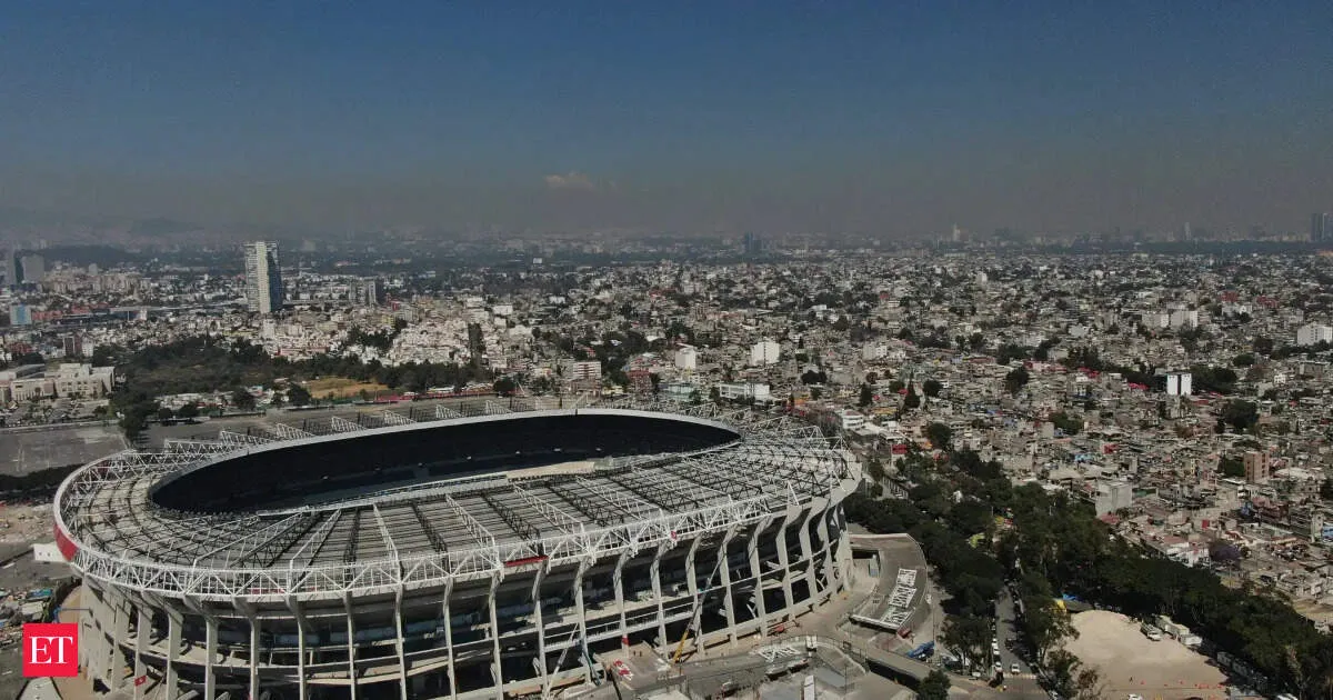
Mexico City is preparing for the World Cup with 18 free public fan zones, a top-tier food scene, and major landmarks like Zócalo and Chapultepec Park. Organizers expect heavy crowds and intense rush-hour traffic near Estadio Azteca, alongside pollution concerns and the challenge of high altitude. Getting to the stadium is easiest via Metro Line 2 or Line 3 plus connections, but visitors are warned about intermittent internet, cashless payments, and safety risks near Santa Ursula.
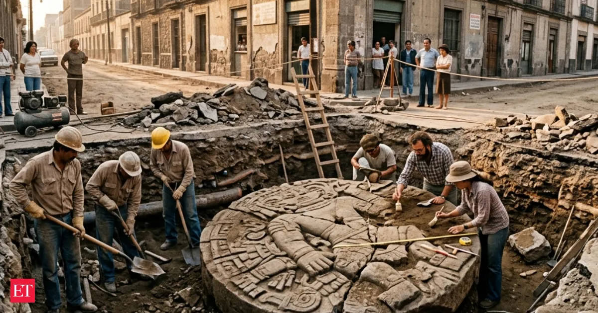
In 1978, routine roadwork in Mexico City unearthed a colossal stone carving of the Aztec goddess Coyolxauhqui. The discovery became a turning point, triggering extensive excavations at the Templo Mayor, the ceremonial center of Tenochtitlan. Findings suggested that large parts of the sacred district still survived beneath the modern city, reshaping understanding of Aztec history and urban life.
Your news, in seconds
Get the Beige app — every story in 60 words, updated hourly. Free on iOS & Android.
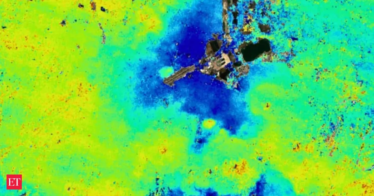
NASA’s NISAR satellite has captured troubling new measurements of Mexico City’s ground collapse, with some areas dropping nearly half an inch every month. The long-running sinking trend, worsened by groundwater extraction and rapid urbanization, is now being tracked with dual-frequency radar for sharper, neighborhood-level data. The findings could guide mitigation and safer urban planning.
Swipe through stories, personalise your feed, and save articles for later — all on the app.